.png)
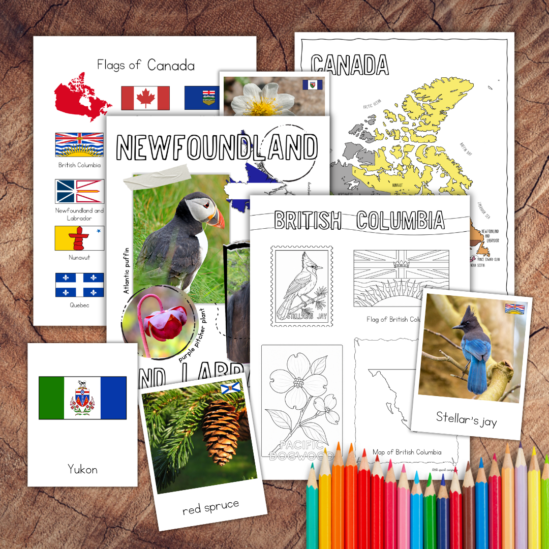

Canadian Geography Bundle
Explore all 10 Canadian provinces and 3 territories with seven coordinated printable resources combining Montessori 3-part cards, puzzle maps, reference posters and subject-specific research journals covering flags, birds, flowers, trees and regional geography.
This Canadian Geography Bundle brings together hands-on Montessori matching materials, colourful reference posters, puzzle maps and printable research pages. Children can progress from recognizing provincial and territorial symbols to locating each region on a map and completing their own geographic research.
SEVEN RESOURCES ARE INCLUDED
1. Canadian Bird Emblems Montessori 3-Part Cards, Reference Poster and Research Journal
Learn to identify and match the bird emblems associated with Canada’s provinces and territories. This resource also includes 13 research journal pages—one for each province and territory—allowing children to record what they learn about every regional bird emblem.
2. Canadian Floral Emblems Montessori 3-Part Cards, Reference Poster and Research Journal
Explore the official flowers and plants representing Canada’s provinces and territories through matching cards and accompanying research journal pages.
3. Canadian Tree Emblems Montessori 3-Part Cards, Reference Poster and Research Journal
Identify and compare Canada’s provincial and territorial tree emblems using Montessori 3-part cards and coordinated research journal pages.
4. Canadian Flags Montessori 3-Part Cards, Reference Poster and Research Journal
Become familiar with the distinctive flags of Canada’s provinces and territories through hands-on matching activities and corresponding research journal page.
5. Canadian Provinces and Territories Poster Set
This reference set includes:
• 10 province posters
• 3 territory posters
• 1 bonus Canada poster
Each provincial and territorial poster features the region’s name, flag, bird, flower and animal.
The posters are formatted for standard US letter-sized paper measuring 8.5 × 11 inches. They can also be printed on A4 paper by selecting “Fit to Page” in your printer settings.
6. Canadian Provinces and Territories Research Pack
This 21-page, no-preparation research pack includes:
• 4 Canada map colouring pages
• 13 province- and territory-specific research worksheets
• 4 additional research pages that can be used with any selected province or territory
Each regional worksheet features the province or territory name, its location on a map, flag, bird and flower.
The additional research pages provide space to investigate topics such as capitals, mottos, landmarks, native plants and animals, and other interesting geographic information.
The research pack is prepared in black and white for easy prep. Children can add their own colour while completing their work.
7. Canada Puzzle Maps
Use the printable puzzle-map activities to practice recognizing, locating and assembling Canada’s provinces and territories.
A COORDINATED CANADIAN GEOGRAPHY STUDY
Rather than presenting Canadian geography as a collection of unrelated facts, these resources can be used as a learning progression:
• Introduce the provinces and territories with the poster set
• Locate and identify each region with the puzzle maps
• Match flags and natural emblems with the Montessori 3-part cards
• Compare symbols among different regions
• Complete the research pages for selected provinces and territories
• Assemble completed pages into a Canadian geography notebook
SKILLS PRACTISED
• Identifying Canada’s 10 provinces and 3 territories
• Locating provinces and territories on a map
• Recognizing provincial and territorial flags
• Identifying Canadian bird, floral and tree emblems
• Matching pictures, labels and control cards
• Developing map-reading and visual discrimination skills
• Organizing and recording geographic information
• Conducting independent research
• Building Canadian geography vocabulary
IDEAL FOR
• Montessori cultural shelves
• Homeschool geography studies
• Elementary classrooms
• Canadian social studies units
• Geography centres
• Independent research projects
• Mixed-age learning environments
• Canada Day learning activities
The individual resources can be introduced according to each child’s readiness. Younger children can begin with the posters, maps and matching cards, while more experienced learners can use the research pages to extend their study.
DIGITAL DOWNLOAD
This is a digital product. No physical materials will be mailed.
You will receive a downloadable PDF containing instructions and a private link to access all seven resources included in the bundle.
Adobe Acrobat Reader is recommended for opening and printing the files. For frequently handled cards and puzzle-map pieces, printing on cardstock and laminating after cutting is recommended.
Colours may vary slightly depending on your monitor, printer, ink and paper.
TERMS OF USE
For personal use or use by one educator in one classroom. Files may not be shared, resold, redistributed, uploaded to shared drives or included in another product. Additional licences are required for use by multiple educators or classrooms.


