.png)


50 States Geography Bundle | US State Research, Maps, Posters & Symbols
Teach all 50 states with one coordinated collection of printable geography resources!
This seven-resource bundle combines research pages, fact cards, maps, posters and Montessori-style three-part cards to help students explore state locations, capitals, flags, birds, flowers, trees, mottos and other identifying features.
Use the resources together for a complete 50 States unit or select individual activities for geography centers, research projects, independent work and review.
WHAT’S INCLUDED
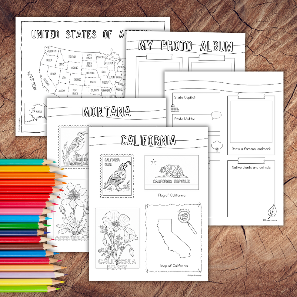
US States Research Pack
• One 60-page printable PDF
• Four US map colouring and geography pages
• One state-specific activity page for each of the 50 states
• Four reusable extended-research pages
Each state page introduces the state’s name, location, flag, bird and flower. The additional pages provide space to investigate capitals, mottos, trees, landmarks, native plants and animals, and interesting facts.
USA 50 States Fact Cards
• 50 black-and-white state fact cards
• Prepare as double-sided cards or 100 single-sided matching cards
• Includes state map outline, abbreviation, full name, capital, bird, flower, tree and motto
US States Poster Set
• 50 individual state posters
• One USA overview poster
• State maps, flags, birds, flowers and representative animals
United States Puzzle Map Control Sheets
• Four printable US map control sheets
• Colour-coded and black-and-white options
• Useful with Montessori USA puzzle-map work
US State Birds Three-Part Cards
• 28 distinct state birds representing all 50 states
• Montessori-style three-part cards
• Reference poster and coordinated extension
US State Flowers Three-Part Cards
• 40 distinct flowers represented across 50 state cards
• Montessori-style three-part cards
• Reference poster and coordinated extension
US State Flags Three-Part Cards
• All 50 state flags
• Montessori-style three-part cards
• Reference poster and coordinated extension
WAYS TO USE THIS BUNDLE
• Complete one state each week
• Create a year-long 50 States study
• Organize states by geographic region
• Build geography or social-studies learning centers
• Assign individual or group state research projects
• Compare state symbols and natural emblems
• Prepare for or document a family road trip
• Pair the materials with a Montessori USA puzzle map
• Use the posters and fact cards for daily review
SKILLS SUPPORTED
• US geography and map awareness
• Recognition of state locations and symbols
• Research and information gathering
• Reading comprehension
• Vocabulary development
• Matching, sorting and classification
• Written communication
• Independent project work
IDEAL FOR
• Elementary classrooms
• Homeschool geography
• Montessori elementary environments
• Social-studies units
• Geography centers
• Homeschool co-ops
• Multi-age learning environments
The open-ended collection works across multiple ability levels. Younger students can match cards, colour maps and identify symbols, while older students can complete independent research and written state reports.
PLEASE NOTE
This collection focuses on the 50 US states. US overseas territories are not included.
Individual resources from this bundle are also available separately.